• Call: +62274 – 885879
  • Chat : +62813-2552-3979
  • Mail : info@technogis.co.id
  • en
    • en
    • id
Equator GNSS | GeoLiDAR | NiVO Drone | Blue Marine | Landcam
TechnoGIS Indonesia
  • Home
  • About
    • About TechnoGIS
    • Our Awesome Team
    • Partners & Networks
    • Look at GIS & Geographic Insight
    • 3 Keys Our Focus for Innovation
    • Social Responsibility
    • Terms and Conditions
    • Contact
  • GIS Hosting
    • PostGIS Cloud Database
    • Geoserver Cloud
    • Geonode Cloud
  • Software
    • GIS Survey Mobile
    • TGIS Cloud Dashboard
    • TGS Post Processing
    • iTSensing Cloud Image Processing
  • Instruments
    • TGS Low Cost RTK Reciever
    • NiVO VTOL Drone Mapping
    • Blue Marine Echosounder
    • GeoLiDAR Laser Scanner
    • Landcam Multispectral Camera
  • Solutions
    • CadGIS – Cadastral & Civil
    • TaniGIS – Agriculture
    • MinerGIS – Mining & Energy
    • DesaGIS – Urban Planning
    • BisnGIS – Geo Business Tools
    • NavnGIS – Navigation & Tracker
    • CarbonPlot – Carbon Balancing
    • PowerGIS – Powerline Inspection
    • TelcoGIS – Telco Tower Inspection
  • News & Updates
  • Academic
    • Online Webinar
    • Short Course & Training
    • Certification
  • Store
  • Login
  • Menu Menu

Optimalisasi Penggunaan Drone PPK DJI Mavic 3 Enterprise dengan Software Lokal TGS Post Processing dengan Software Lokal TGS Post Processing dalam Integrasi Teknologi untuk Pemetaan Presisi

4 Maret 2025
/
0 Comments
Webinar ini membahas pemanfaatan maksimal drone PPK DJI Mavic…
https://technogis.de/wp-content/uploads/2025/03/WhatsApp-Image-2025-03-04-at-10.55.07-1.jpeg 1069 1080 Muhammad Habibi https://www.technogis.co.id/wp-content/uploads/2023/08/LOGO-TECHNOGIS_PNG.png 
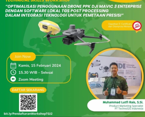
Muhammad Habibi2025-03-04 13:55:212025-03-28 14:52:12Optimalisasi Penggunaan Drone PPK DJI Mavic 3 Enterprise dengan Software Lokal TGS Post Processing dengan Software Lokal TGS Post Processing dalam Integrasi Teknologi untuk Pemetaan Presisi

Menggali Potensi Pesawat Udara Nir Awak (PUNA) NIVO VTOL V2 menggunakan Modul PPK TGS R1 untuk Level Akurasi Tinggi

4 Maret 2025
/
0 Comments
Webinar ini akan mengupas teknologi Pesawat Udara Nir Awak (PUNA)…
https://technogis.de/wp-content/uploads/2025/03/WhatsApp-Image-2025-03-04-at-10.55.07-2.jpeg 1068 1080 Pamungkas https://www.technogis.co.id/wp-content/uploads/2023/08/LOGO-TECHNOGIS_PNG.png Pamungkas2025-03-04 12:36:042025-07-08 11:12:35Menggali Potensi Pesawat Udara Nir Awak (PUNA) NIVO VTOL V2 menggunakan Modul PPK TGS R1 untuk Level Akurasi Tinggi
Page 6 of 6«‹456

About Us

TechnoGIS is a Geospatial technology company with low-cost survey tool products, cloud mapping software and geospatial data mapping and analysis services from Indonesia.

One of the best geospatial startup company in South East Asia with focusing on environment problem and bring solution to natural disaster, degradation foresty, land mapping and surveying, mining and energy also smart city.


Office Address

Main Office
Jl Pamularsih No.152 B,
Klaseman, Sinduharjo, Ngaglik, Sleman, Yogyakarta, Indonesia, 55283

PIDI 4.0 Building 8th Floor
Jl Raya Kby. Lama No.41, RT.6/RW.8, Sukabumi, Kb. Jeruk, West Jakarta, Indonesia, 11560

Phone : +62274 – 885879
Mobile : +62813-2552-3979
Email : info@technogis.co.id

Our Products

Instruments:
TGS RTK GNSS, NiVO Drone VTOL Mapping, GeoLiDAR, Blue Marine, Landcam Multispectral

Software:
GIS Survey Mobile, TGIS Cloud GIS, TGS Post Processing, iTSensing


© Copyright 2015 - Techno GIS Indonesia
  • Facebook
  • Instagram
  • Rss
  • LinkedIn
  • Youtube
Scroll to top